Burhill Fort - an Iron Age Fort located at Buckland near Broadway - postcode WR12 7LY Burhill hill fort occupies a spur on the Cotswold escarpment overlooking Buckland and the Severn/Avon valley. Very little remains of any ramparts, except for a stretch on the eastern side, against the slope of the scarp, indicating an entranceway. The Hill Fort on Burhill, also recorded on an early OS Map as Burrell Hill was discovered only in 1960 when Mr L.V. Grinsell recognised the possible implication of the first element on the name (Old English Burh meaning 'fortification'). A study of occupation in 1989 by Alistair Marshall - click here
(22 miles N.N.E. of Cirencester) ¶(1) Hill-Fort (SP 085363), on Burhill, univallate, unexcavated, occupies a spur of the Cotswold escarpment ¼ mile N.E. of the village; parts of the bank have been levelled. The surviving N.E. side is defined by a bank with an outer ditch, now extending less than half-way across the neck of the spur. The bank is 25 ft. wide and 5 ft. high, the ditch 30 ft. wide and 3 ft. deep. Plan, p. 23. 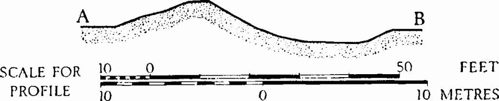 A dozen small sherds of undecorated hand-made pottery, including a simple rim, found in ploughsoil along the inner edge of the bank are in Gloucester City Museum. The hill-fort, not shown on O.S. maps, was discovered by L. V. Grinsell in 1960 (cf. D. Verey, Gloucestershire: The Cotswolds (1970), 140). An area of some 3 hectares (7.4 acres) may have been enclosed, but on most sides the natural scarp is now the only remaining defensive feature. The whole area has been extensively ploughed, and within the hillfort a scatter of early to mid iron-age pottery has turned up. A hillfort is a type of earthworks used as a fortified refuge or defended settlement, located to exploit a rise in elevation for defensive advantage. They are typically European and of the Bronze and Iron Ages. Some were used in the post-Roman period. The fortification usually follows the contours of a hill, consisting of one or more lines of earthworks, with stockadesor defensive walls, and external ditches. Hillforts developed in the Late Bronze and Early Iron Age, roughly the start of the first millennium BC, and were used in many Celtic areas of central and western Europe until the Roman conquest. An area outside the fort, east of the entrance, has produced much greater quantities of pottery dating to the earliest period of the iron age, with many fragments of various jars and bowls.
HISTORIC ENGLAND Click Here to see more An Iron Age univallate promontory hillfort, now partly destroyed. The fort encloses approximately 12 acres and pre-Iron Age activity is indicated by a scatter of flints over the spur. Other finds from the interior include a Prehistoric saddle quern and Early and Middle Iron Age pottery, suggesting the hillfort was constructed and occupied during the earliest phases of the Iron Age. A pillow mound near the top of the slope on the south-eastern side of the fort is recorded separately (see NMR SP 03 NE 17). Another mound is situated at the top of the scarp on the south-western side of the fort and could be part of the hillfort ramparts, or another pillow mound. The site is partially visible on aerial photographs. Burhill | | Hob Uid: 328049 | | Location :
Gloucestershire
Tewkesbury
Buckland | | Grid Ref : SP0845036270 | | Summary : An Iron Age univallate promontory hillfort, now partly destroyed. The fort encloses approximately 12 acres and pre-Iron Age activity is indicated by a scatter of flints over the spur. Other finds from the interior include a Prehistoric saddle quern and Early and Middle Iron Age pottery, suggesting the hillfort was constructed and occupied during the earliest phases of the Iron Age. A pillow mound near the top of the slope on the south-eastern side of the fort is recorded separately (see NMR SP 03 NE 17). Another mound is situated at the top of the scarp on the south-western side of the fort and could be part of the hillfort ramparts, or another pillow mound. The site is partially visible on aerial photographs. | More information : (SP 084363) A small univallate hill-fort was discovered
by L V Grinsell in 1960 on Burhill. The NE side is defended by a bank
with outer ditch, the other sides by the natural scarp of the
hill-side. The bank, which now extends less than halfway across
the neck of the spur, is 25 ft wide and 5 ft high, with a ditch
30ft wide and 3 ft deep. A dozen small sherds of undecorated
hand-made pottery, found along the inner edge of the bank, are in
Gloucester City Museum. (1-2)
SP 084363. A promontory fort enclosing some 12 acres. The bank on
the east side of the fort has been destroyed by ploughing at its
south end, but is up to 2.5m high in the north. There is no outer
ditch, but in the north east is an outer bank forming an overlapping
entrance. The other sides of the fort are defended solely by the
natural slope of the hillside. Built into this slope on the south
side of the fort is a pillow mound (SP 03 NE 17) Surveyed at 1:2500.
(3)
SP084363 The defences of the hillfort only survive on the north-eastern side as a fragment of univallate rampart. A small collection of abraded sherds were discovered dating to the early and middle Iron Age in the ploughed surface of the hillfort interior and are now in the Cheltenham and Gloucester Museums. A single decorated rim with finger tip and finger nail indentations was found. A saddle quern of prehistoric type has also been found in the interior. Pre Iron Age activity has been discovered as a flint scatter covering the spur (4-5)
SP 085 363. Burhill. Listed in gazetteer as a univallate hillfort. (6)
Hill-Fort (SP 085363), on Burhill, univallate, unexcavated. Parts of the bank have been levelled. [Additional information and plan included]. (7)
The Iron Age univallate promontory hillfort described above is centred at SP 0845 3627 and is partially visible on aerial photographs. A 125m long fragment of bank on the north-eastern corner is visible as an earthwork between SP 08446 3638 and SP 0856 3633. There is no clear evidence of ramparts extending around the margin of the spur as a complete circuit, only naturally steep scarp on the north, west and south sides. However, a possible section of mound 24m long is visible along the top of the scarp, 55m north of the south-western corner, centred at SP 0839 3618, and may have formed part of the ramparts. Alternatively, the mound is of similar proportions to a pillow mound which lies near the top of the southern slope, at SP 0847 3615 (see NMR SP 03 NE 17 / UID: 328058), and could be a second Medieval or Post-Medieval pillow mound on the spur. The hillfort is not particulary well sited for defence on the north-eastern side as the the hill-top rises slightly above the hillfort and it's interior may have been overlooked. (8) |
|